Subscribe
63°

Severe Thunderstorm Watch Issued For These Parts Of PA
A broad new weather alert has been issued as a potent line of storms approaches the Northeast.
The National Weather Service issued a Severe Thunderstorm Watch just before 4 p.m. Friday, Oct. 16, for all of New Jersey and parts of New York, Connecticut, Pennsylvania, Delaware, and Maryland. The watch is in effect until 10 p.m.
In New York, the watch covers downstate areas, including New York City, Long Island, the Hudson Valley, and Westchester County. Western Connecticut is also included.
Areas (in yellow) covered by the Severe Thunderstorm Watch that lasts through 10 p.m. Friday, O…
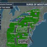
Rapidly Advancing Storm To Trigger Major Northeast Weather Change: Timing
A quick-moving storm will bring more than rain to the Northeast, leaving a sharp change in its wake just as the weekend begins.
The National Weather Service forecasts showers reaching New York City overnight Thursday, Oct. 15, continuing Friday, Oct. 16, before colder air arrives Saturday, Oct. 17. Temperatures will fall from the mid-70s Friday to around 50 Saturday.
Farther north, Boston’s NWS forecast calls for Friday rain, followed by clearing Saturday and highs around 50. Northwest gusts could reach about 30 mph.
The contrast will extend south. NWS forecasters expect Washington, DC, to…
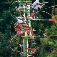
Power Outages Soar Past 100K After Severe Storms Slam Pennsylvania Again
More than 100,000 homes and businesses were without power across Pennsylvania on Friday, Sept. 4, after another round of severe storms brought destructive winds, torrential rain, flooding, and tornado warnings.
Approximately 102,700 customers remained in the dark Friday morning, more than twice the 43,000 reported Thursday morning and five times Wednesday afternoon’s total, according to PowerOutage.us.
The latest storms shifted the heart of the outage crisis to western Pennsylvania. The hardest-hit counties included:
Westmoreland County: 42,045 outages.
Allegheny County: 20,667 outages.
C…
More Winter Weather Alerts Issued In NJ, PA As Tuesday Storm Aims At Morning Commute
Winter weather alerts have been issued across North Jersey and eastern Pennsylvania ahead of Tuesday’s storm, which is expected to bring several inches of snow and slippery roads during the morning commute, according to the National Weather Service.
A Winter Storm Watch is in effect for Sussex County, where 4 to 7 inches of snow and snowfall rates of up to 1 inch per hour are possible.
Winter Weather Advisories have been issued for Hunterdon, Morris, Warren, and Western Passaic counties, forecasters said.
In Pennsylvania, winter weather advisories cover Berks, Lehigh, Northampton, Upper Bu…